OGC API Features Guideline

Geonovum Guide
Living document

This version:
https://docs.geostandaarden.nl/api/ld-hr-ogc-api-features-guideline-20240514
Latest published version:
https://docs.geostandaarden.nl/api/ogc-api-features-guideline/
Latest editor's draft:
https://geonovum.github.io/ogc-api-features-guideline/
Previous version:
https://docs.geostandaarden.nl/api/ld-hr-ogc-api-features-guideline-20240508
Editor:
Pieter Bresters (Geonovum)
Author:
Pieter Bresters (Geonovum)
Participate:
GitHub Geonovum/ogc-api-features-guideline
File an issue
Commit history
Pull requests

Abstract

This document is a guideline for Dutch data providers who want to use OGC-API-Features for download services in a way that they comply with relevant standards. The guideline has been written on the basis of the experiences gained from implementations of OGC-API-Features of INSPIRE datasets on test beds. A second important basis is formed by the results of an open tender, held in the beginning of 2023. This tender aimed at adjusting tools for serving OGC-API-feature services to 3 standards: OGC, Dutch Application Design Rules and INSPIRE. Until this tender, no tools were known that comply with all these standards. This guideline describes the requirements, as set out by the standards and uses the demo services from this open tender as an example of how one can comply with the standards. The aim of setting up these test beds and this guideline, has been to stimulate the Dutch data providers and hosting organizations to start publishing data as OGC API Features. By doing this, a greater goal is reached: A better use of geospatial data.

A general recommendation to all parties involved, is to adjust as much as possible to the existing requirements as stated in this document. The most important recommendations for the hosting organizations is to stimulate data providers to start with OGC API features to increase the use of geospatial data according to standards. Data providers are recommended to first orientate on the possible work of other data providers in this field. A roadmap is described with the steps needed to be taken by data providers in order to serve OGC-API-Features.

Status of this document

This is a living document, which is updated regularly.

1. OGC API Features explained

OGC API Features (OAPIF) is a multi-part standard for services that offer the capability to create, modify, and query spatial data on the Web. It specifies requirements and recommendations for APIs that want to follow a standard way of sharing feature data. The specification is a multi-part document. [PUB-1], [PUB-5], [PUB-6].

OAPIF is also the term used for a feature download service by means of an API (Application Program Interface) based on OGC standards. OAPIF has been considered as the successor of the OGC WFS standard, but that does not mean it will replace it in the near future, although eventually it might. At this moment, they are complementary to each other. Where WFS is mainly known and used in the GIS community, the OAPIF is aiming at the non GIS-community, like web developers. OAPIF is easier to use and needs less knowledge in the spatial domain. Note as well that WFS adopts the Geography Markup Language (GML) as a default data format. In contrast, OAPIF includes recommendations to support HTML and GeoJSON as encodings. Implementations of OAPIF may also optionally support GML.

The basis of an OAPIF is the landing page. Examples are shown in https://geonovum.github.io/ogc-api-features-guideline/#H04. An OAPIF consists of resources that can be retrieved by typing the corresponding path after the landing page of the OAPIF in a web browser or web application.

Resource Path Purpose
Landing page / This is the top-level resource, which serves as an entry point.
Conformance declaration /conformance This resource presents information about the functionality that is implemented by the server.
API definition /api This resource provides metadata about the API itself. Note that the use of /api on the server is optional and the API definition may be hosted on a completely separate server.
Feature collections /collections This resource lists the feature collections that are offered through the API.
Feature collection /collections/{collectionId} This resource describes the feature collection identified in the path.
Features /collections/{collectionId}/items This resource presents the features that are contained in the collection.
Feature /collections/{collectionId}/items/{featureId} This resource presents the feature that is identified in the path.

In the API definition, one can find all the supported encodings (HTML, JSON) and parameters that can be given along with the URL, such as a bounding box or a limit of the amount of features. By default, an OAPIF service will provide access to a single dataset. Rather than sharing the data as a complete dataset, the OGC API Features standards offer direct, fine-grained access to the data at the feature (object) level.

The best way of understanding the concept is looking at the examples that are discussed in the chapter of examples.

Since providing a download service is an INSPIRE requirement when responsible for an INSPIRE dataset, the use of OAPIF can be considered for this purpose. It is even seen as an endorsed Good Practice within the INSPIRE community.

While the OAPIF is aiming at the non GIS-community, it is also easy to use for GIS-specialists within a GIS as is shown in the image below. It works the same as loading a WFS. Only a service name and landing page is required.
 

GIS-example
Figure 1 Example of using OAPIF in QGIS

2. Roadmap for data providers

The following steps could be considered to follow in order to serve an OGC API Feature service according to the standards:

  1. Read this document and all the documents in Appendix A.
  2. Make a choice between publishing by yourself or contact a hosting organization that can help you publish the OAPIF services.
  3. In case of an INSPIRE-dataset, look what other data providers have done in this field for the concerning INSPIRE themes and have a look at these examples: https://github.com/INSPIRE-MIF/gp-ogc-api-features/tree/master/deployments.
  4. If you decide to serve the OAPIF yourself, the next step is to select the best tooling for your situation. The examples in this guideline might help in this regard.
  5. Figure out the best way of supporting more than one CRS, at least WGS84 and in case of INSPRE also ETRS89 since the last is the most common in INSPIRE and mostly mandatory. Dutch providers are also advised to provide the Dutch RD. If tooling is chosen that is not able to serve more than one CRS, a second download option should be provided that does give the data in the required CRS.
  6. Decide on the best input encoding for the OAPIF. It depends on the previous steps and tooling.
  7. If necessary, execute the transformation into the chosen input encoding. This can be done with software like HALE studio, FME or GDAL.
  8. Decide on the best output encoding, which also depends on the previous steps and tooling. The tooling used in the examples did a simple 1 to 1 mapping between the input and output encoding.
  9. In case of an INSPIRE-dataset, research whether a previously published mapping to an encoding other than complex GML can be found for the concerned INSPIRE-theme. If so, it can be reused. If it cannot be found, research how your harmonized data can be mapped to an encoding that can be used in the tooling. Seek for cooperation with other INSPIRE data providers in Europe and use the principles as stated in [PUB-4]. The INSPIRE data models contain many non-obligatory fields that remain empty after harmonizing. Consider leaving out these empty fields to reduce the output size or use an option not to show them.
  10. In case of an INSPIRE-dataset, if not published before, describe the mapping from the INSPIRE data model to the output encoding of the OAPIF and publish it, in order to be INSPIRE compliant.
  11. Adjust your metadata of the dataset with the addition of the OAPIF service. The ISO19115 metadata standard uses the protocol element to state the type of service. As long as there is no official protocol defined for OAPIF in https://inspire.ec.europa.eu/metadata-codelist/ProtocolValue:1, use the extended code list for the protocol in the Dutch metadata standard 2.1.0 (https://docs.geostandaarden.nl/md/mdprofiel-iso19119/#codelist-protocol): OGC:API features.
  12. If you host your OAPIF yourself, research how to make metadata for the OAPIF service. It is probably similar to the metadata of a WFS, except for the protocol element.
  13. Add as many links, i.e. references to other resources, as you can at the response to the endpoints of your service to describe your service. In case of an Inspire dataset, all the links as mentioned in the chapter on requirements are required (metadata of dataset, INSPIRE feature concept dictionary, Licence, mapping description, bulk download).
  14. The steps for final actual publishing of the OAPIF service depends on the chosen tool, so there the tooling guidelines need to be followed:
  1. Validate the OAPIF service for the OGC requirement with the INSPIRE validation tool and in case of a Dutch provider: the Dutch ADR-validator.
    Adjust where possible to be compliant. It should be noted that the INSPIRE-validator is the same as the OGC validator and that it does not test the specific INSPIRE requirements as one would expect.

3. Requirements

Below the most relevant requirements (or requirement classes) for setting up an OAPIF are listed:

Nr Source requirements reference
1 OAS Open API Specification https://www.openapis.org/
2 OGC OGC API Features Core [PUB-1]
3 OGC CRS requirements [PUB-5]
4 OGC OGC filtering [PUB-6]
5 Dutch ADR Dutch API design rules [PUB-3]
6 INSPIRE INPSIRE-MIF document: Setting up an INSPIRE Download service based on the OGC API-Features standard [PUB-2]
7 INSPIRE CRS requirements [PUB-2] #req-crs
8 INSPIRE multilinguality [PUB-2] #82-requirements-class-inspire-multilinguality-
9 INSPIRE [predefined download](https://github.com/INSPIRE-MIF/gp-ogc-api-features/blob/master/spec/oapif-inspire-download.md#req-pre-defined [PUB-2] #req-pre-defined
10 INSPIRE bulk download [PUB-2] #req-bulk-download
11 INSPIRE GeoJSON [PUB-2] #req-oapif-json
12 INSPIRE INSPIRE validated GML as input and output https://inspire.ec.europa.eu/validator/about/ and [PUB-1] #_requirements_classes_for_encodings
13 INSPIRE describing encoding [PUB-4]

3.1 OAS

The Open API Specification as set up by the OpenAPI Initiative requires a document that describes an API or elements of an API. It can mostly be obtained by typing "openapi" behind the URL of the landing page of the service. An OpenAPI document uses and conforms to the OpenAPI Specification. It describes all the possible fields that can or should be used in the OpenAPI document. The OpenAPI document MUST contain at least one paths field, a components field or a webhooks field.

3.2 OGC

3.2.1 OGC API Features Core

OGC API Features Core, [PUB-1] describes the basic requirements (50) and recommendations (17) according to OGC that one needs to follow, independent of INSPIRE. It describes which paths can be used and what responses one should receive. It does not make the use of the OpenAPI Specification 3.0) mandatory, but if it is used, it gives an extra requirement class. Presumably, this also counts for higher versions of the OpenAPI Specification.

The GeoJSON requirement class in [PUB-1] recommends to support GeoJSON for features with geometry, but as stated in https://docs.opengeospatial.org/is/17-069r4/17-069r4.html#_encodings, no encoding is mandatory.

Metadata links are recommended in [PUB-1] #rec_core_fc-md-descriptions.

There is an INSPIRE validation on the OGC standards for OAPIF available. It tests on OGC requirements, but it does not test the requirements as stated in [PUB-2].   

INSPIRE Validator
Figure 2 Validation on the OGC standards for OAPIF

3.2.2 OGC CRS requirements

Both OGC and INSPIRE have requirements related to the CRS's used in addition to the basic requirement from the OGC API Features Core standard. The CRS requirement in the OGC API Features Core standard [PUB-1], requires WGS84 for 2D-data and WGS84h for 3D-data as default. The OGC API - Features - Part 2 standard, [PUB-5] prescribes how to support different coordinate systems with OAPIF. Among other requirements, the requirements concern a CRS identifier list, Storage-CRS, a bbox-crs parameter and a content-CRS in the header of the body of the response.

3.2.3 OGC Filtering

The specification for filtering, [PUB-6] is still a draft version and has therefore not yet been taken into account. Some basic filtering requirements are described in OGC API - Features - Part 1: Core [PUB-1]. This only concerns filtering with a bounding box and on properties.

3.3 Dutch API design rules

Dutch data providers are recommended to follow the Dutch API design rules, [PUB-3] and the Geomodule.

For the Dutch data providers, it is recommended to also support RD-coordinatesystem for 2D data or RD +NAP for 3D data. See also: https://docs.geostandaarden.nl/crs/crs.

3.4 INSPIRE

INSPIRE-MIF document: Setting up an INSPIRE Download service based on the OGC API-Features standard, [PUB-2] describes the specific INSPIRE requirements. Most of them are explained in the next chapters. This document does propose in Note 2 to make it a mandatory requirement for INSPIRE to comply with OAPIF requirements class OpenAPI 3.0.

3.4.1 INSPIRE CRS

The INSPIRE-CRS requirement class in [PUB-2] requires also one of the INSPIRE CRS's based on ETRS89 to be supported.

3.4.2 INSPIRE Multilinguality

The multilinguality requirement class, [PUB-2] is mandatory for all data sets that contain information in more than one natural language. This is mostly not the case in the Netherlands, so it is of less importance.

3.4.3 INSPIRE Predefined download

The predefined download requirement class,[PUB-2] consists of 3 requirements for each collection to include links to:

  1. the metadata of the corresponding dataset in [PUB-2]
  2. the corresponding entry in the INSPIRE feature concept dictionary
  3. the license

3.4.4 INSPIRE Bulk download

The bulk download requirement class, [PUB-2] requires links for enclosure of the total data set and/or of each separate collection.

3.4.5 INSPIRE and GeoJSON

The GeoJSON requirement class in [PUB-2] recommends to document how the GeoJSON encoding is retrieved from the INSPIRE data models.

3.4.6 INSPIRE and GML

The use of GML as encoding for INSPIRE data can be considered in two ways: as input and as output.

When we consider the input, one would like to be able to use a source dataset of harmonized data. In most cases, this will be a GML encoded dataset. The GML encoding is at least needed to validate the data set with the EU INSPIRE validator.
Unfortunately, not many tooling for creating a OAPIF service is able to use GML as input. Especially when it concerns a complex GML dataset. So, a transformation to another encoding like GeoJSON is needed.

Output of GML from the OAPIF service can only be in simple features level 0 and level 2. So no complex features will be supported.

3.4.7 INSPIRE Describing encoding

The standards considered in this guideline do not set a specific encoding as mandatory (see https://docs.opengeospatial.org/is/17-069r4/17-069r4.html#_encodings) [PUB-1]. If another encoding than GML is used for publishing an INSPIRE dataset, data providers need to document how the encoding relates to the concerned INSPIRE data model. The good practice on GeoPackages encoding of INSPIRE datasets describes how this can be done.

3.5 Relevant documentation

Relevant documentation is shown in appendix A. References.

4. Examples of implementations after tool adjustments

From earlier tests Geonovum concluded tools were not compliant with the requirements for OAS, OGC, INSPIRE and Dutch ADR. For that reason Geonovum set up an open tender at the beginning of the year 2023, with the goal of improving the compliance of OGC API tooling. This resulted in 3 demo services that each show how you can be compliant with the requirements. All demo services used the same selection of the Dutch INSPIRE Addresses in a simplified GML file, constructed by Wetransform as input.

tool main contributions landing page
Pygeoapi Justobjects and Geocat https://apitestbed.geonovum.nl/adr_pygeoapi/v1
Geoserver Geosolutions https://geonovum.geosolutionsgroup.com/geoserver/inspire/ogc/features/v1
Deegree Wetransform https://test.haleconnect.de/ogcapi/datasets/simplified-addresses/v1

Per tool, findings are elaborated in the next chapters when relevant.

4.1 Pygeoapi versus requirements

The following findings show how Pygeoapi complies to the requirements.

4.1.1 OAS

The OAS document is available: https://apitestbed.geonovum.nl/adr_pygeoapi/v1/openapi

4.1.2 OGC

The OGC CITE validator gave no error at the landing page.

Filtering

For the use of filters, the bbox and items options were already available. In addition, one can filter on the attributes which can be retrieved from https://apitestbed.geonovum.nl/adr_pygeoapi/v1/collections/AddressesNL/queryables. The OGC API specification for filtering [PUB-6] does not yet have the status "approved" and has not yet been considered.

CRS

The crs identifier list and storage-crs can be found at the end of: https://apitestbed.geonovum.nl/adr_pygeoapi/v1/collections/AddressesNL?f=json

With the following command line request, one can see the Content-CRS value in the header:

curl -i https://apitestbed.geonovum.nl/adr_pygeoapi/v1/collections/AddressesNL/items/1?f=json

An adjustment has been made to the bbox filter. It now also supports the bbox-crs parameter. Only 2 addresses are available in the below defined bbox. https://apitestbed.geonovum.nl/adr_pygeoapi/v1/collections/AddressesNL/items?f=json&bbox-crs=http://www.opengis.net/def/crs/EPSG/0/28992&bbox=252200,593000,252710,594000

4.1.3 Dutch API design rules

It complies with all the rules, except for rule https://publicatie.centrumvoorstandaarden.nl/api/adr/#api-48. This rule in the Dutch ADR prescribes that none of the API endpoints should have a trailing slash. However, the OGC specification states that the landing page (i.e. "Home") should have a trailing slash. So the rules contradict. It is expected that in future, this ADR-rule will make an exception for the landing page.

4.1.4 INSPIRE

CRS ETRS89 and WGS84

The required CRS's are available:

Predefined download

Link to metadata of dataset: passed at /collections/AddressesNL and at /collections level:
{"href": "https://www.nationaalgeoregister.nl/geonetwork/srv/dut/catalog.search#/metadata/a5f961e9-ebdd-41e2-b8e8-ab33ed340a83", "hreflang": "nl", "type": "text/html", "rel": "describedby", "title": "Metadata as HTML"}

{"href": "https://www.nationaalgeoregister.nl/geonetwork/srv/api/records/a5f961e9-ebdd-41e2-b8e8-ab33ed340a83/formatters/xml", "hreflang": "nl", "type": "application/xml", "rel": "describedby", "title": "Metadata as ISO 19139 XML"}

Link to INSPIRE feature concept dictionary: passed at /collections/AddressesNL and at /collections level:
{"href": "https://inspire.ec.europa.eu/featureconcept/Address", "hreflang": "en", "type": "text/html", "rel": "tag", "title": "INSPIRE feature concept dictionary for addresses"}

Link to the license: passed at /collections/AddressesNL and at /collections level:
{"href": "https://creativecommons.org/publicdomain/zero/1.0/deed.en", "hreflang": "en", "type": "text/html", "rel": "license", "title": "CC0 1.0 Public Domain license"}

See also https://apitestbed.geonovum.nl/adr_pygeoapi/v1/collections?f=json and https://apitestbed.geonovum.nl/adr_pygeoapi/v1/collections/AddressesNL?f=json

bulk download

Link to bulk download of dataset: passed at /collections/AddressesNL and at /collections level.

See also https://apitestbed.geonovum.nl/adr_pygeoapi/v1/collections?f=json and
https://apitestbed.geonovum.nl/adr_pygeoapi/v1/collections/AddressesNL?f=json {"href": "https://service.pdok.nl/kadaster/ad/atom/downloads/addresses.gml.gz", "hreflang": "nl", "length": 685450191, "type": "application/x-gmz", "rel": "enclosure", "title": "Download complete dataset as GML"}

GeoJSON

Items can be retrieved in GeoJSON by requesting:

https://apitestbed.geonovum.nl/adr_pygeoapi/v1/collections/AddressesNL/items?f=json

GML

As input, a simple features GML file was used as produced by Wetransform from the complex feature GML with the transformation software Hale.

As output, there is a link to the original complex feature GML-file: https://service.pdok.nl/kadaster/ad/atom/downloads/addresses.gml.gz

Pygeoapi does not support GML-output at item-level, but this is not a requirement.

Describing encoding

There is a link to https://github.com/INSPIRE-MIF/2017.2/tree/master/GeoJSON/ads at collections/AddressesNL level:

{"href": "https://github.com/INSPIRE-MIF/2017.2/tree/master/GeoJSON/ads", "hreflang": "en", "type": "text/html", "rel": "about", "title": "Description of the encoding"}

4.1.5 Other findings on Pygeoapi

More information about the Pygeoapi adjustments to the standards can be found at https://pygeoapi.io/presentations/geonovum-tender-2023/

4.2 Geoserver versus requirements

The following findings show how Geoserver complies to the requirements.

4.2.1 OAS

The OAS document is available: https://geonovum.geosolutionsgroup.com/geoserver/inspire/ogc/features/v1/openapi

4.2.2 OGC

The OGC CITE validator gave no error at the landing page https://geonovum.geosolutionsgroup.com/geoserver/inspire/ogc/features/v1.

Filtering

For the use of filters, the bbox and items options were already available. In addition, one can filter on the attributes which can be retrieved from: https://geonovum.geosolutionsgroup.com/geoserver/inspire/ogc/features/v1/collections/SimpleAddress?queryables.

The OGC API specification for filtering [PUB-6] does not yet have the status "approved" and has not yet been considered.

CRS

The crs identifier list and the storage-crs can be found at: https://geonovum.geosolutionsgroup.com/geoserver/inspire/ogc/features/v1/collections/SimpleAddress?f=json

With the following command line request, one can see the Content-CRS value in the header :

curl -i https://geonovum.geosolutionsgroup.com/geoserver/inspire/ogc/features/v1/collections/SimpleAddress/items/1?f=json

An adjustment has been made to the bbox filter. It now also supports the bbox-crs parameter. Only 2 addresses are available in the below defined bbox.

https://geonovum.geosolutionsgroup.com/geoserver/inspire/ogc/features/v1/collections/SimpleAddress/items?f=json&bbox-crs=http://www.opengis.net/def/crs/EPSG/0/28992&bbox=252200,593000,252710,594000

4.2.3 Dutch API design rules

It complies with all the rules, except for rule https://publicatie.centrumvoorstandaarden.nl/api/adr/#api-48. This rule in the Dutch ADR prescribes that none of the API endpoints should have a trailing slash. However, the OGC specification states that the landing page (i.e. "Home") should have a trailing slash. So the rules contradict. It is expected that in future, this ADR-rule will make an exception for the landing page.

At first the collection was named "AddressesNL". At a later stage, it has been changed to "SimpleAddress". This is not according to the rule for naming collections because it is not a plural.

4.2.4 INSPIRE

CRS ETRS89 and WGS84

The required CRS's are available:

Predefined download

Link to metadata of dataset: passed at /collections/collection level and at /collections level. {"href":"https://www.nationaalgeoregister.nl/geonetwork/srv/api/records/a5f961e9-ebdd-41e2-b8e8-ab33ed340a83/formatters/xml?approved=true","rel":"describedBy","type":"application/xml","title":"ISO metadata for this dataset"}

Link to INSPIRE feature concept dictionary: passed at /collections/collection level. {"href":"https://inspire.ec.europa.eu/featureconcept/Address","rel":"tag","type":"text/html","title":"INSPIRE Address feature concept."}

Link to the license: passed at /collections level. {"href":"http://creativecommons.org/publicdomain/zero/1.0/deed.nl","rel":"license","type":"text/html","title":"Dataset license."}

bulk download

Link to bulk download of dataset: passed at /collections/collection level.
{"href":"https://geonovum.geosolutionsgroup.com/geoserver/www/ADNL.gpkg","rel":"enclosure","type":"application/geopackage+sqlite3","title":"Addresses raw data."}

GeoJSON

Items can be retrieved in GeoJSON by requesting:

https://geonovum.geosolutionsgroup.com/geoserver/inspire/ogc/features/v1/collections/SimpleAddress/items/1?f=application%2Fgeo%2Bjson

GML

As input, a simple features GML file was used as produced by Wetransform from the complex feature GML with the transformation software Hale.

As output, the following link can be found at /collections/collection level. It can be used to download the first 50 records.

{"href":"https://geonovum.geosolutionsgroup.com/geoserver/inspire/ogc/features/v1/collections/SimpleAddress/items?f=application%2Fgml%2Bxml%3Bversion%3D3.2","rel":"items","type":"application/gml+xml;version=3.2","title":"Addresses items as application/gml+xml;version=3.2"}

Describing encoding

There is a link to https://github.com/INSPIRE-MIF/2017.2/blob/master/GeoJSON/ads/simple-addresses.md at /collections/collection level.

{"href":"https://github.com/INSPIRE-MIF/2017.2/blob/master/GeoJSON/ads/simple-addresses.md","rel":"describedBy","type":"text/html","title":"GeoJSON Encoding Rule for INSPIRE Addresses"}

4.2.5 Other findings on Geoserver

More information about the Geoserver adjustments to the standards can be found at https://www.geonovum.nl/uploads/documents/Geosolutions.pdf

4.3 Deegree versus requirements

The following findings show how Geoserver complies to the requirements.

4.3.1 OAS

The OAS document is available: https://test.haleconnect.de/ogcapi/datasets/simplified-addresses/v1/openapi

4.3.2 OGC

The OGC CITE validator gave no error at the landing page: https://test.haleconnect.de/ogcapi/datasets/simplified-addresses/v1.

Filtering

For the use of filters, the bbox and items options were already available.

The OGC API specification for filtering [PUB-6] does not yet have the status "approved" and has not yet been considered.

CRS

The crs identifier list and storage-crs can be found at: https://test.haleconnect.de/ogcapi/datasets/simplified-addresses/v1/collections/SimpleAddress?f=json

With the following command line request, one can see the Content-CRS value in the header :

curl -i https://test.haleconnect.de/ogcapi/datasets/simplified-addresses/v1/collections/SimpleAddress/items?limit=1

An adjustment has been made tot the bbox filter. It now also supports the bbox-crs parameter. Only 2 addresses are available in the below defined bbox. https://test.haleconnect.de/ogcapi/datasets/simplified-addresses/v1/collections/SimpleAddress/items?f=json&bbox-crs=http://www.opengis.net/def/crs/EPSG/0/28992&bbox=252200,593000,252710,594000

4.3.3 Dutch API design rules

It complies with all the rules, except for rule https://publicatie.centrumvoorstandaarden.nl/api/adr/#api-48. This rule in the Dutch ADR prescribes that none of the API endpoints should have a trailing slash. However, the OGC specification states that the landing page (i.e. "Home") should have a trailing slash. So the rules contradict. It is expected that in future, this ADR-rule will make an exception for the landing page.

4.3.4 INSPIRE

CRS ETRS89 and WGS84

The required CRS's are available:

Predefined download

Link to metadata of dataset: passed at /collections level:

{"href":"https://www.nationaalgeoregister.nl/geonetwork/srv/dut/catalog.search#/metadata/a5f961e9-ebdd-41e2-b8e8-ab33ed340a83","rel":"describedby","type":"text/html","title":"Metadata"}

Link to INSPIRE feature concept dictionary: passed at /collections/collection level and at /collections level:

{"href":"https://inspire.ec.europa.eu/featureconcept/Address","rel":"tag","type":"text/html","title":"Feature concept Address"}

Link to the license: passed at /collections level:

{"href":"http://creativecommons.org/publicdomain/zero/1.0/deed.nl","rel":"license","type":"text/html","title":"License"}

bulk download

Link to bulk download of dataset: passed at /collections/collection level and at /collections level.

{"href":"http://test.haleconnect.de/ogcapi/datasets/simplified-addresses/collections/SimpleAddress/items?bulk=true","rel":"enclosure","type":"application/xml","title":"Download all features as GML"} {"href":"http://test.haleconnect.de/ogcapi/datasets/simplified-addresses/collections/SimpleAddress/items?bulk=true","rel":"enclosure","type":"application/json","title":"Download all features as GeoJSON"}

GeoJSON

Items can be retrieved in GeoJSON by requesting:

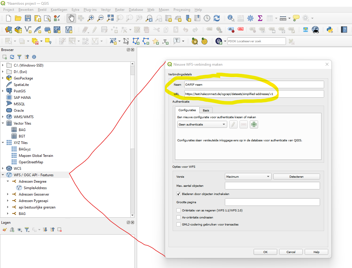
https://test.haleconnect.de/ogcapi/datasets/simplified-addresses/collections/SimpleAddress/items?f=json&limit=1

or

https://test.haleconnect.de/ogcapi/datasets/simplified-addresses/collections/SimpleAddress/items/nl-imbag-ad-address-0003200000133985?f=json

GML

As input, a simple features GML file was used as produced by Wetransform from the complex feature GML with the transformation software Hale. As output, the following links can be found at /collections/collection level. They can be used to download specific records.

{"href":"http://test.haleconnect.de/ogcapi/datasets/simplified-addresses/collections/SimpleAddress/items?bulk=true","rel":"enclosure","type":"application/xml","title":"Download all features as GML"}

or

{"href":"http://test.haleconnect.de/ogcapi/datasets/simplified-addresses/collections/SimpleAddress/items","rel":"items","type":"application/gml+xml;version=3.2","title":"Features as GML"}

(use parameter f=xml)

Describing encoding

There is a link to https://github.com/INSPIRE-MIF/2017.2/blob/master/GeoJSON/ads at /collections/collection level.

{"href":"https://github.com/INSPIRE-MIF/2017.2/tree/master/GeoJSON/ads","rel":"describedby","type":"text/html","title":"Encoding description"}

4.3.5 Other findings on Deegree

More information about the Deegree adjustments to the standards can be found at https://www.geonovum.nl/uploads/documents/deegree%20OGC%20API%20Features.pdf

4.4 General findings

  1. There has been discussion whether the predefined download links should be at collections or collections/collection level. See also: https://github.com/INSPIRE-MIF/gp-ogc-api-features/issues/91.
    During the project of adjusting the tools we had the opinion that both should be possible.
    Afterwards, we found out that it should be at collections level since it is one of the main principles in [PUB-2] to use one data set in one API.
  2. The protocol element in the metadata is based on a code list. A new protocol needs to be added to this list of protocol values. As long as it is not there, the Dutch profile for metadata can be used with the value: "OGC:API features" https://geonovum.github.io/Metadata-ISO19119/#codelist-protocol.
  3. Another blocking issue before implementation of the OAPIF for INSPIRE is that descriptions of encodings other than GML are not yet available for most INSPIRE themes.
  4. Complex GML as input and output are difficult as long as tooling (server and client) expects simple encodings.
  5. One could discuss if it is useful to publish complex GML as output, because it is not in line with the aim of OGI API Features: easy to use for developers.
  6. Complex GML as input needs a flattening of the data. This is needed for the software that publishes the features. It can only work with simple features, with one value per attribute and without relations to other objects. This is often not the case with the more complex INSPIRE models.

4.5 Resulting documentation

Presentations can be found here: https://www.geonovum.nl/over-geonovum/actueel/presentatie-resultaten-aanbesteding-ogc-api-features-toolaanpassing

A. References

A.1 Informative references

[PUB-1]
OGC API Features Part1:Core. OGC. V1.0. URL: https://docs.opengeospatial.org/is/17-069r4/17-069r4.html
[PUB-2]
Setting up an INSPIRE Download service based on the OGC API-Features standard. INSPIRE-MIF. V1.0. URL: https://github.com/INSPIRE-MIF/gp-ogc-api-features/blob/master/spec/oapif-inspire-download.md
[PUB-3]
Dutch API design rules. https://www.geonovum.nl. 19 JULI 2020. URL: https://www.geonovum.nl/over-geonovum/actueel/rest-api-design-rules-op-pas-toe-leg-uit-lijst
[PUB-4]
INSPIRE UML-to-GeoJSON encoding rule. Working group on Inspire Action 2017.2. V0.1. URL: https://github.com/INSPIRE-MIF/2017.2/blob/master/GeoJSON/geojson-encoding-rule.md#inspire-requirements-for-encoding-rules
[PUB-5]
OGC API - Features - Part 2: Coordinate Reference Systems by Reference. OGC. V1.0. URL: http://docs.opengeospatial.org/is/18-058r1/18-058r1.html
[PUB-6]
OGC API - Features - Part 3: Filtering and the Common Query Language (CQL). OGC. V1.0.0, draft. URL: https://docs.ogc.org/DRAFTS/19-079r1.html
Geonovum Guide - Living document